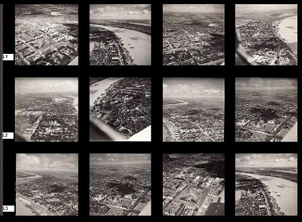
En
1960, les premiers techniciens spécialisés en cartographie et photos
aériennes rentraient de France où ils effectuaient leurs formations
dans l'armée de l'air française. De retour au Cambodge, ils
continuaient à prendre les photos à main levée derrière un hublot ou un
cockpit comme cela fut le cas dans les années cinquante. En 1962 un
premier avion fut aménagé pour les prises de vues aériennes; un
L-20 Beaver. Des trous furent percés dans le plancher et des supports
pour appareils photographiques furent installés. En 1964, un MD 315
Flamant fut aussi équipé pour des missions de reconnaissance
photographique.
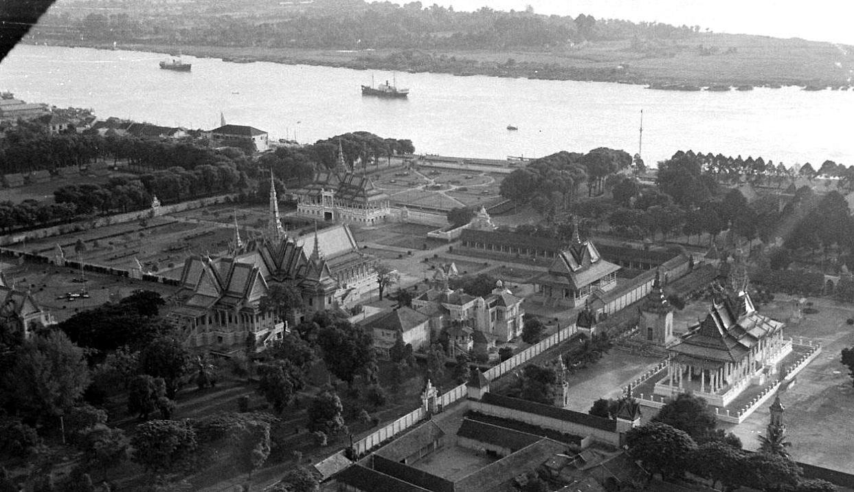
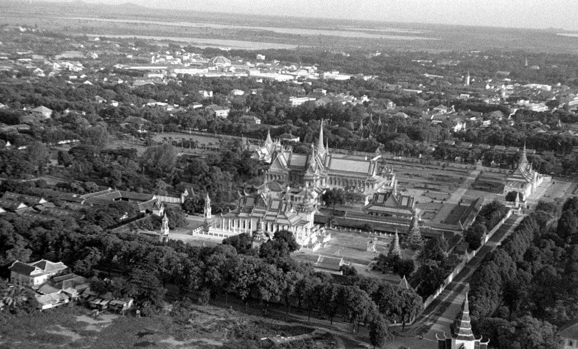
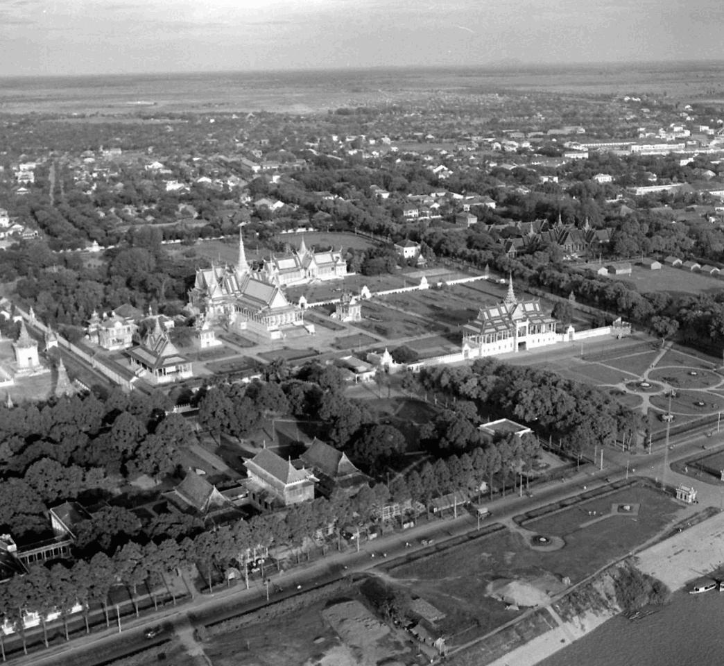
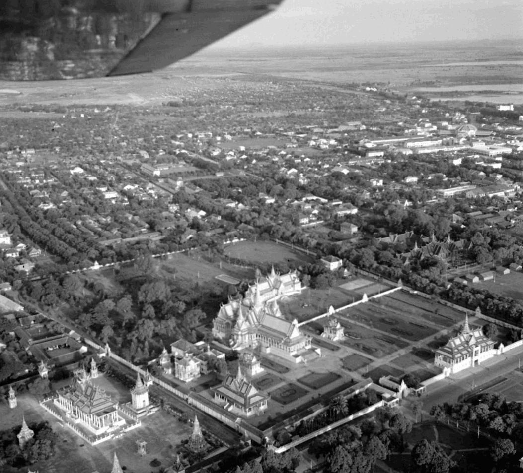
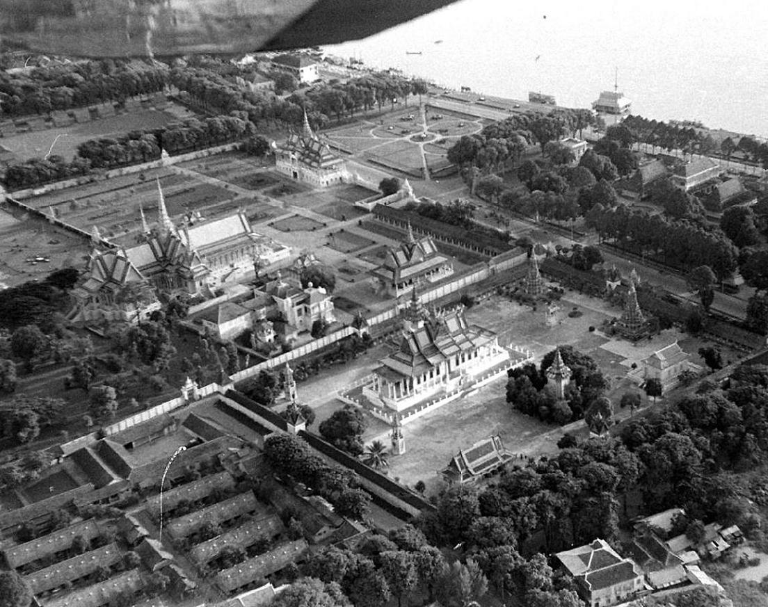
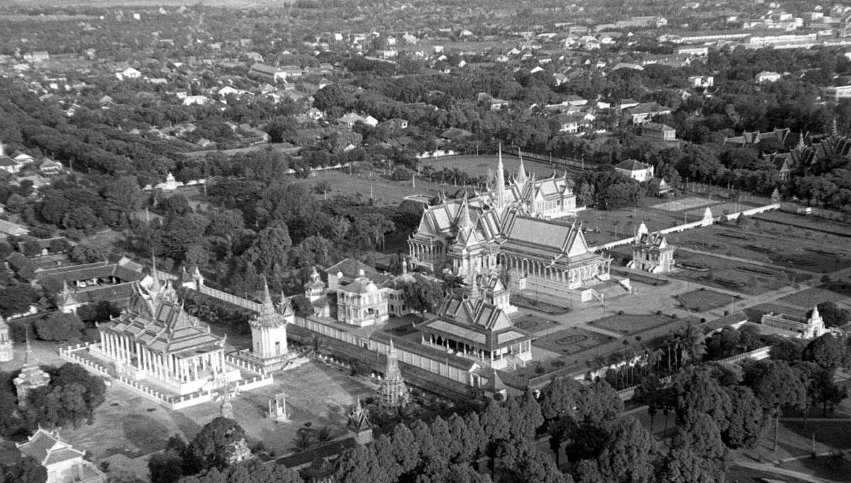
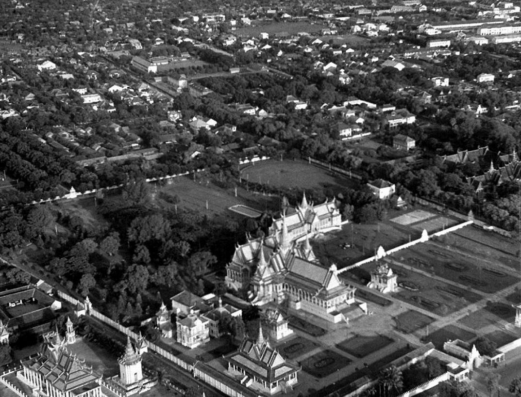
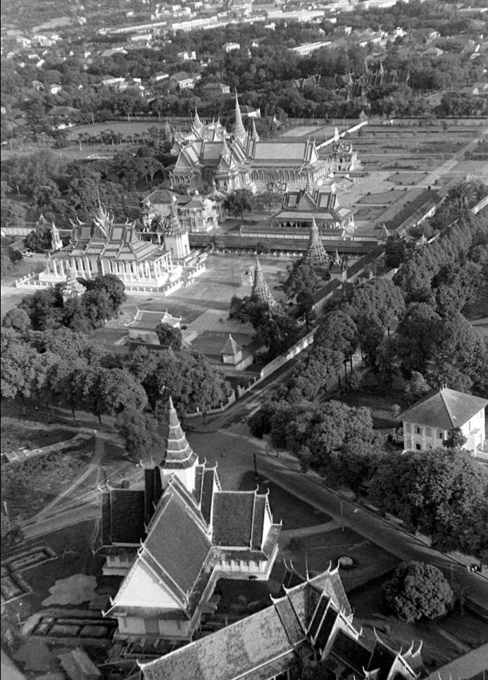
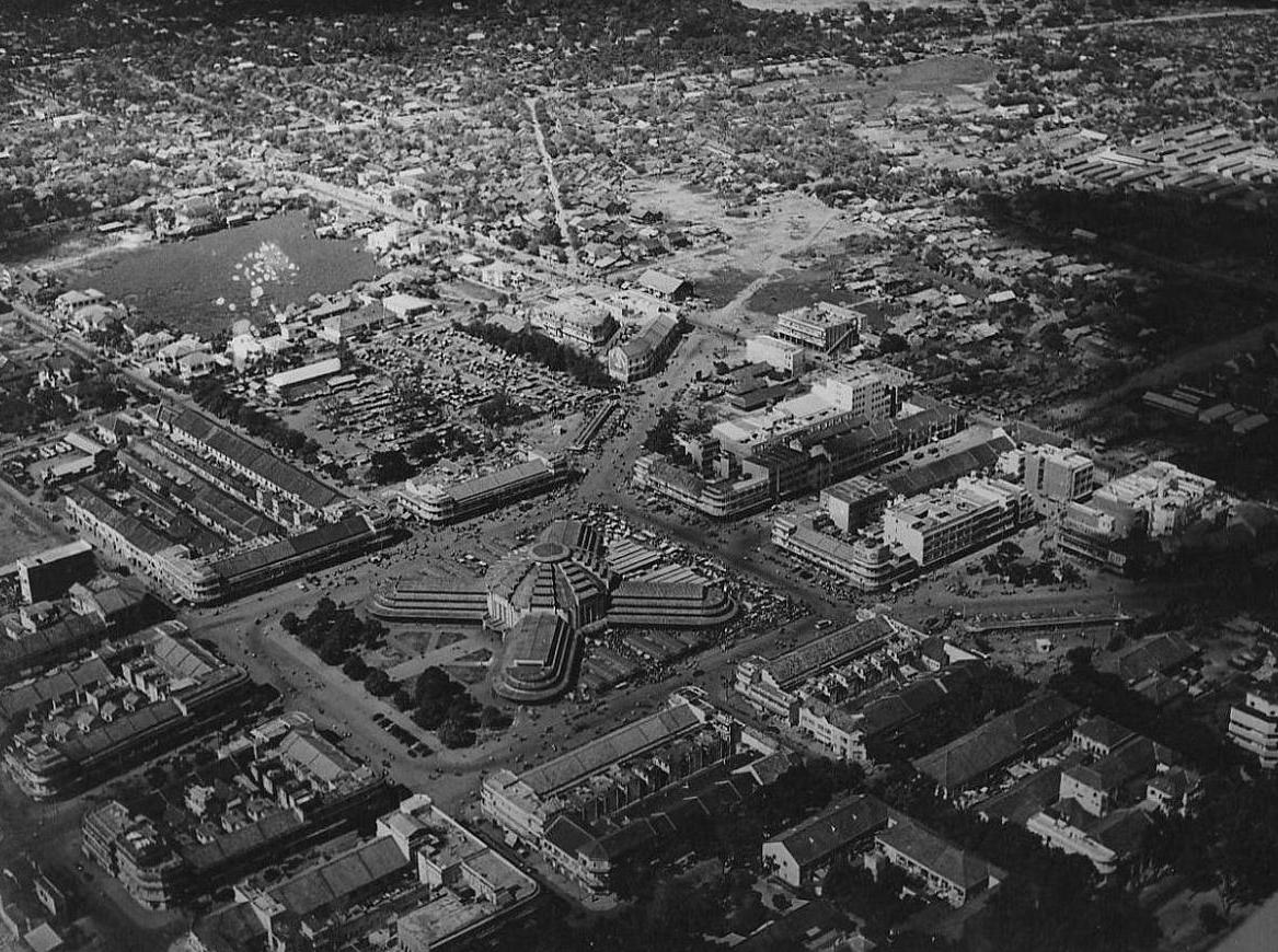
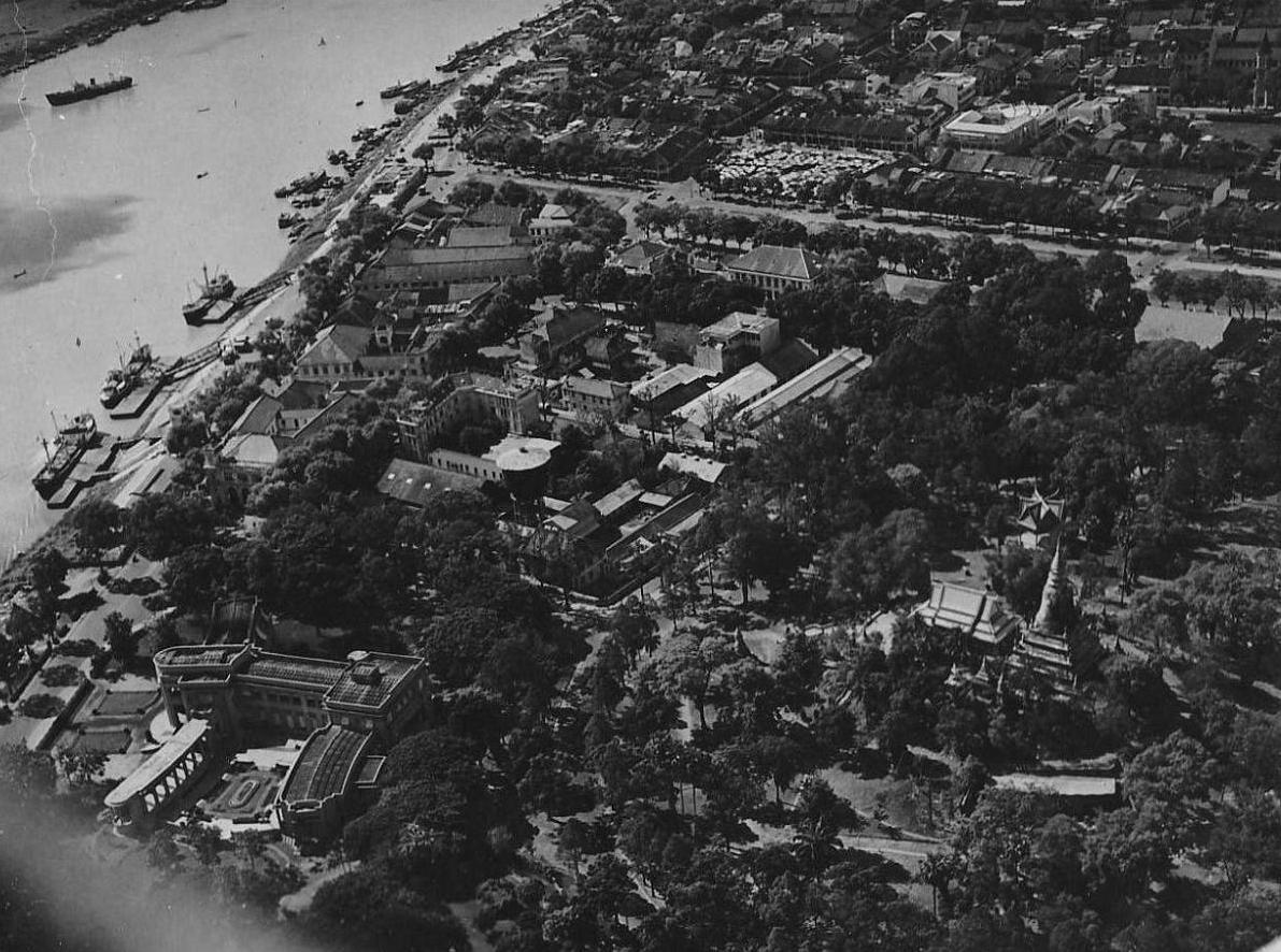
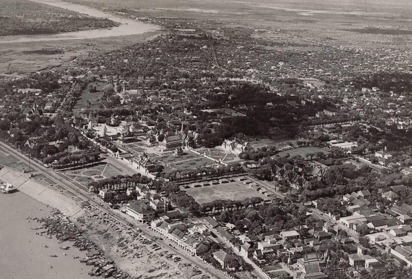
Le Palais Royal vu d'un Beaver
The Royal Palace from a Beaver
|
|
Le
Service Photos et Cartographie de l'aviation était dirigé par
l'officier Saroeun. En plus des besoins militaires, nous effectuions
aussi des prises de vues pour des organismes civils tels que le
Service Géographique National ou encore l'Ecole française
d'Extrême Orient. Au fils du temps, le Service Photo étendra ses
activités pour couvrir aussi les besoins du journal interne ainsi
que les évènements de la vie quotidienne du personnel.
|
|
|
|
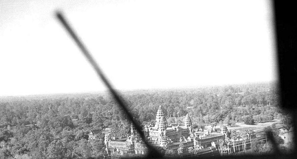
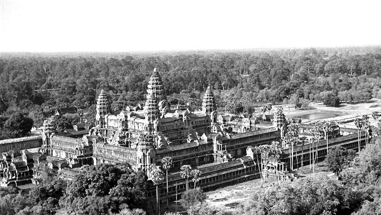
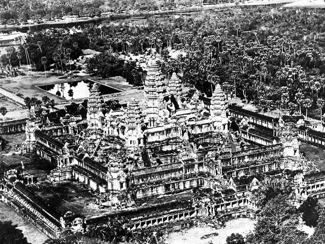
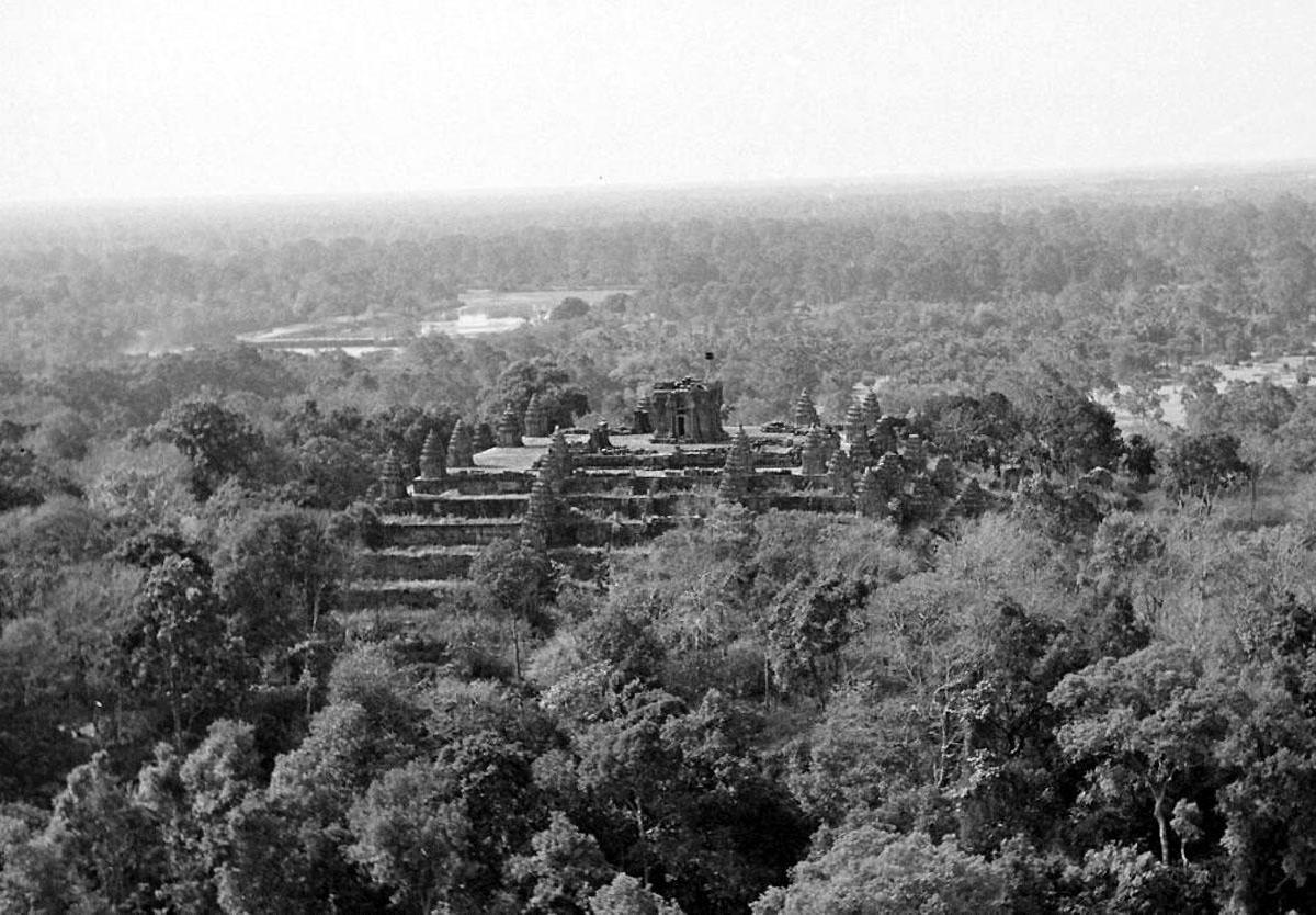
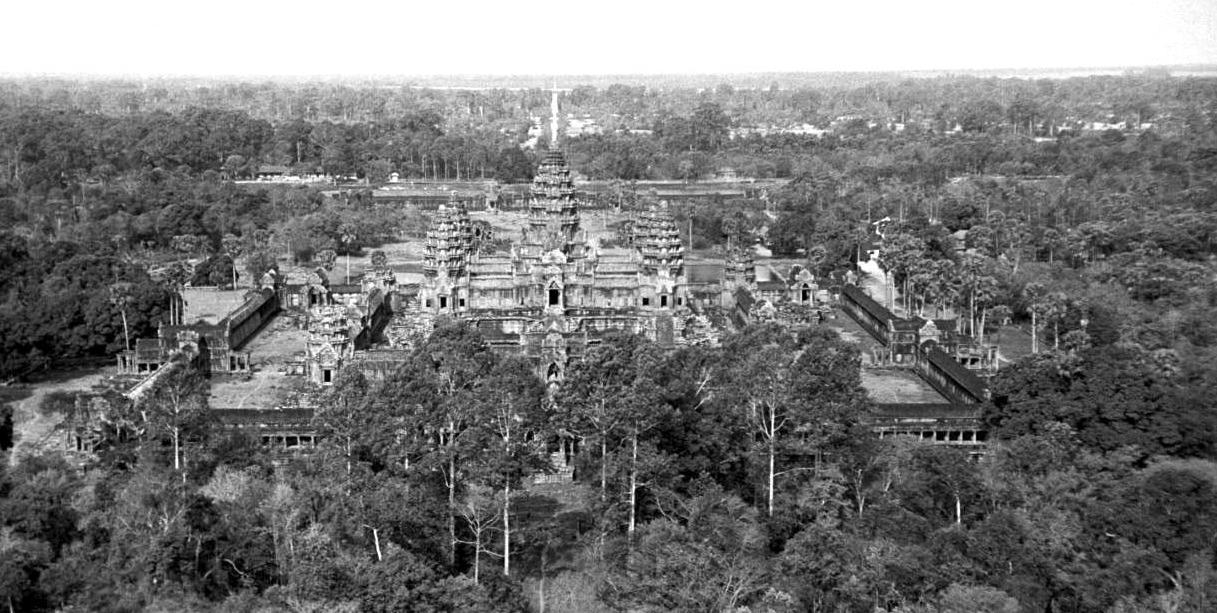
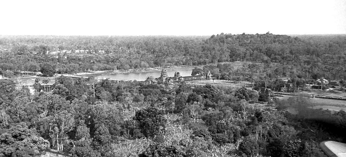
Angkor Temples seen from a C-47 cockpit
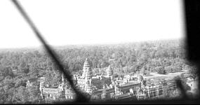
Les temples d'Angkor vus d'un cockpit de C-47
|
The
first technicians qualified in photo-reconnaissance and photo-mapping
returned from their training in France, where they were attached to
French Air Forces units, in 1960. Initially, the lack of specialized
equipments forced them to operate in Cambodia with hand held cameras,
taking pictures from cockpits. In 1962, a first aircraft, an L-20
Beaver, was specially modified for photo reconnaissance tasks. Holes
were cut on the belly of the fuselage and mountings for cameras
installed. It was joined in 1964 by a specially equipped MD-315
Flamant.
The Photographic and Cartographic Department was
commanded by Officer Saroeun. In addition to fulfilling missions in
profit of the military needs, the Department also provided aerial
pictures for civilian institutions like the National Geographic
Department or the French prestigious archeological Far Eastern Studies
School. With time, the Department extended its activities, even editing
the internal magazine which covered the daily life of our Air
Force.
|
|